What a planning authority actually wants from your render
Planning imagery is judged on accuracy, not beauty. What assessors actually look for, why flattering renders get challenged, and where the money is wasted.
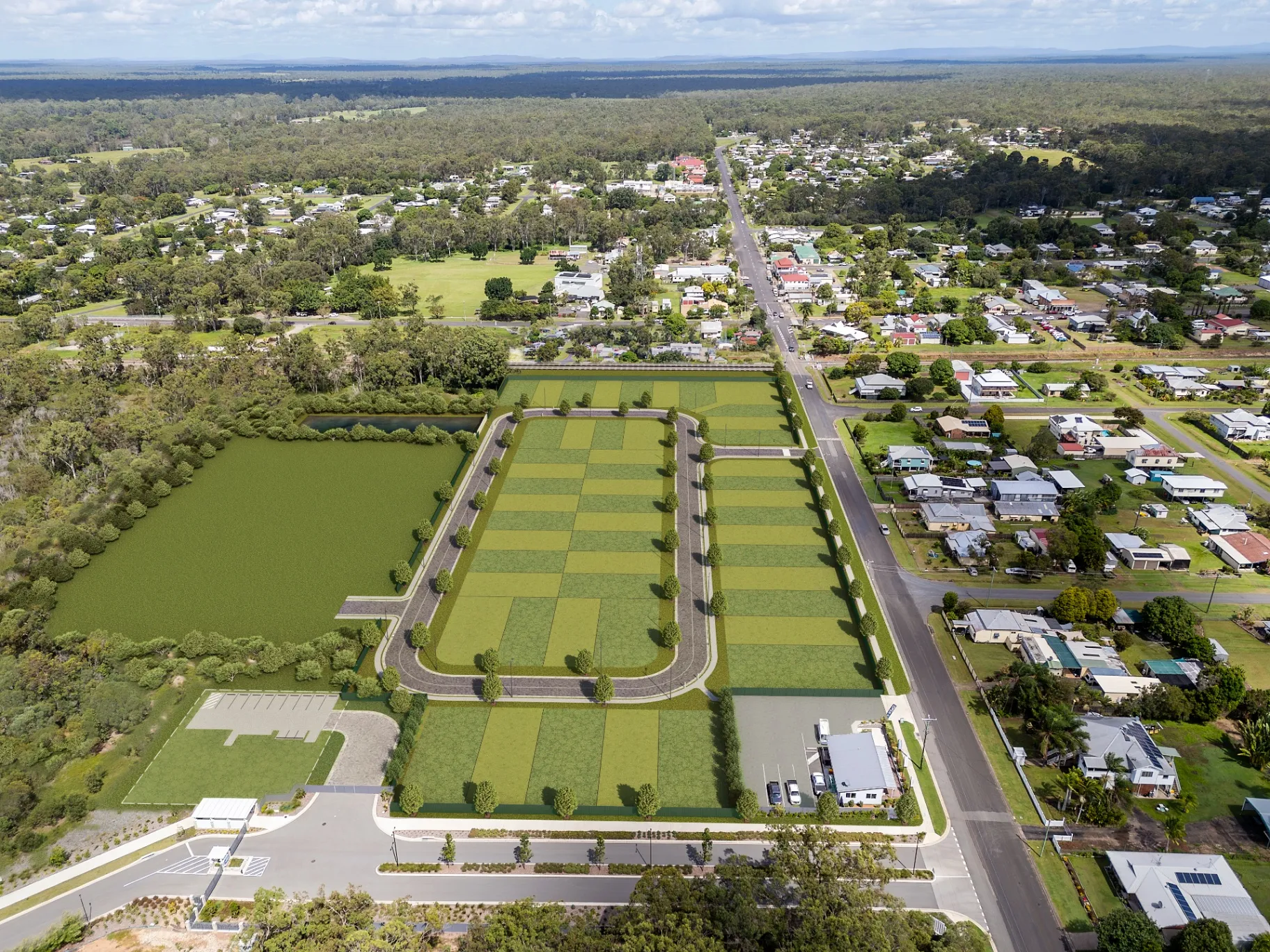
Marketing imagery and planning imagery are different products that happen to be made with the same software, and confusing the two is one of the more expensive mistakes in this industry.
A marketing render is allowed to flatter. It picks the best hour, the best angle, the most generous framing. A planning render is evidence. Its job is to let an assessor understand what will actually be built and how it will actually sit in its context — and the moment it looks like it is selling something, it starts working against you.
This applies whether you call it a development application, a zoning or entitlement submission, or a planning application. The vocabulary changes between jurisdictions; what assessors are looking for does not.
The single biggest mistake
Inventing the context.
It is faster and cheaper to put a plausible-looking backdrop behind a building than to model what is genuinely there. It is also the thing most likely to get your imagery dismissed, and in the worst cases to get the applicant’s credibility questioned on everything else in the submission.
Assessors, objectors and neighbours all know what that street looks like. If the two-storey house next door appears as a single storey, or a mature tree that shades half the site is missing, somebody will notice. And once one element is shown to be wrong, every other image in the pack is treated as unreliable.
Context for planning work should be built from survey data, cadastral boundaries and aerial imagery. Not approximated. Not borrowed from a similar site.
What assessors are actually looking at
Height and bulk against what is next door. The primary question in most residential assessments is whether the proposal is out of scale with its neighbours. The render needs to answer that plainly, from a viewpoint where the comparison is visible.
Setbacks and boundaries. These should be legible in the image, not obscured by a conveniently placed tree.
Overshadowing. Where shadow diagrams are required they are usually a separate technical output, but the render should not contradict them. A hero image lit at an hour that produces no visible shadow, submitted alongside a shadow study showing significant overshadowing, is a gift to an objector.
Materials and finishes as specified. If the schedule says dark grey cladding, the render should not show a softer, friendlier mid-grey because it photographs better.
The view from where people will actually stand. Street-level from the public domain, at eye height. Not from three metres up, which is the default in a lot of visualisation software and which quietly minimises apparent bulk.
Where the money gets wasted
Buying premium imagery for compliance work. This is the big one. An assessor is checking compliance, not admiring your lighting. A competent mid-market render, accurate and well-documented, does this job completely. Paying a premium studio for planning-only imagery is money burned — and any honest studio will tell you so.
Buying too many views. Most submissions need fewer images than people commission. A street elevation in context, one or two from the significant public viewpoints, and an aerial if the site is large. Additional angles rarely change an assessment.
Commissioning planning and marketing imagery separately, from scratch, twice. This is the avoidable one. The model is the expensive part, and it can serve both — build it accurately for planning, then relight, restyle and regrade the same scene for marketing later. That is dramatically cheaper than two independent commissions, and it is worth telling your studio at the outset that both are coming.
The photomontage question
For sensitive sites you may be asked for a photomontage: the proposal composited into a real photograph taken from a specified viewpoint, rather than a fully rendered scene.
These are more work than they look. The camera position, focal length and height have to be recorded on site, then reproduced exactly in the 3D scene so the building sits at the correct scale and perspective in the plate. Lighting has to match the photograph, including the weather on the day it was taken.
If your submission requires verified views, say so up front. It changes the process, the cost and the timeline, and it is not something that can be retrofitted to an existing render.
A practical checklist
□ Context modelled from survey / cadastral data, not invented
□ Eye-height viewpoints from the public domain
□ Sun angles correct for the site's real orientation
□ Materials as specified in the schedule, not as flattered
□ Nothing in the image contradicts the shadow diagrams
□ Viewpoints match any the authority has nominated
□ Photomontage requirements identified before work starts
□ Told the studio if marketing imagery will follow
The uncomfortable summary
If your building is genuinely too big for its site, no render will fix that, and a flattering one makes it worse by inviting scrutiny of everything else you have submitted.
What good planning imagery does is remove doubt. It lets an assessor see clearly what is proposed, satisfy themselves it is what the drawings say, and move on. That is a lower bar than marketing imagery and a completely different one — and knowing which you are buying is most of the battle.
We do planning imagery, and we will tell you plainly when your submission does not need our tier of it. For volume-priced compliance work, 3D Design Studios is the better fit and we will point you there. If the imagery has to do more than satisfy a requirement, send us the drawings.